The following media items used in this module are protected by the details of their copyrights. Please use the "copyright terms" link associated with each media item below for more information.
Click an image to view it at full size in a new browser window/tab.
credits:
US Navy/NRL/ ©EUMETSAT 2007
copyright terms:
COMET Standard Terms of Use
description:
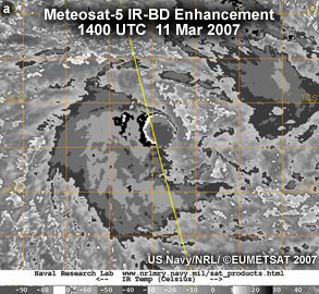
Meteosat-5 IR-BD Enhancement 1400UTC 11 Mar 2007
|
credits:
US Navy/NRL/ ©EUMETSAT 2007
copyright terms:
COMET Standard Terms of Use
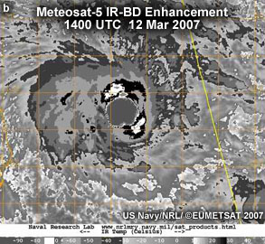
description:
Meteosat-5 IR-BD Enhancement 1400UTC 12 Mar 2007
|
credits:
US Navy/NRL/ ©EUMETSAT 2007
copyright terms:
COMET Standard Terms of Use
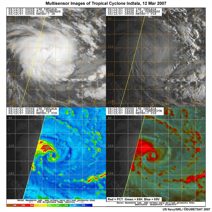
description:
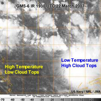
Multisensor Images of Tropical Cyclone Indlala, 12 Mar 2007
|
credits:
US Navy/NRL/ ©EUMETSAT 2007
copyright terms:
COMET Standard Terms of Use
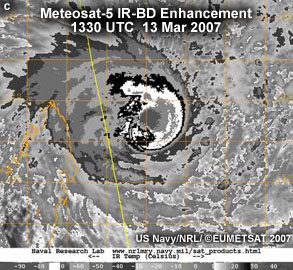
description:
Meteosat-5 IR-BD Enhancement 1330UTC 13 Mar 2007
|
credits:
US Navy/NRL/ ©EUMETSAT 2007
copyright terms:
COMET Standard Terms of Use
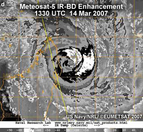
description:
Meteosat-5 IR-BD Enhancement 1330UTC 14 Mar 2007
|
credits:
David Jorgensen
copyright terms:
COMET Standard Terms of Use
description:
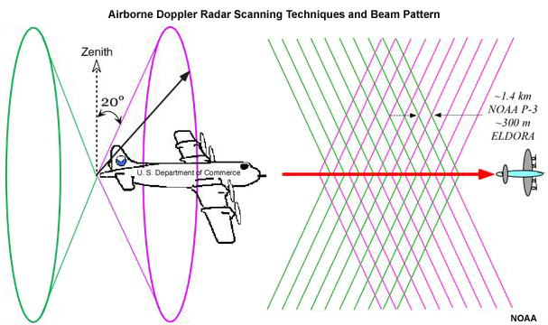
Conceptual model of the airborne Doppler radar scanning techniques and the beam pattern for a single aircraft (image courtesy of Dr. David Jorgensen)
|
|
credits:
NASA
copyright terms:
COMET Standard Terms of Use
description:
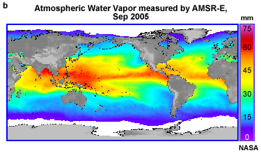
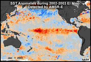
2002-2003 El Nino Sea Surface Temperature Anomalies detected by AMSR-E
|
credits:
left- NOAA, right - US Navy NRL/NASA
copyright terms:
COMET Standard Terms of Use
description:
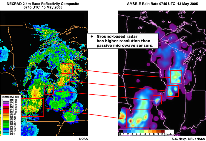
Maps of radar and AMSR precipitation estimates
|
credits:
NOAA, NASA, USAF (no change to current graphic)
copyright terms:
COMET Standard Terms of Use
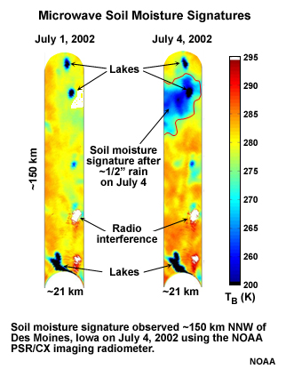
description:
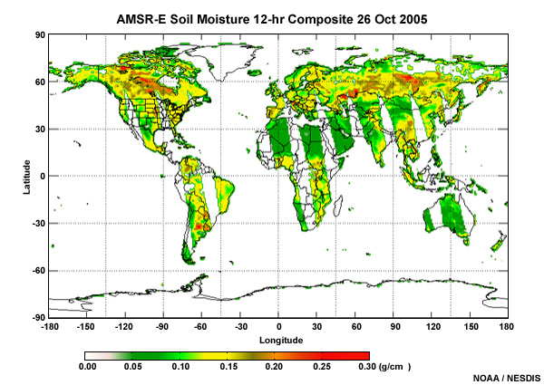
12-hr composite of soil moisture measured by AMSR-E, 26 Oct 2005
|
credits:
Australia Bureau of Meteorology
copyright terms:
COMET Standard Terms of Use
description:
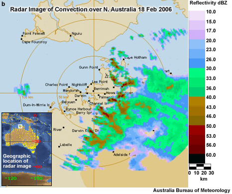
Radar images of convection over NW Australia 18 Feb 2006
|
credits:
Australia Bureau of Meteorology
copyright terms:
COMET Standard Terms of Use
description:
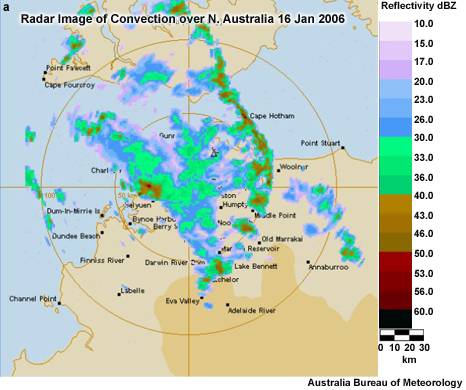
Radar images of convection over NW Australia 16 Jan 2006
|
credits:
©The COMET Program
copyright terms:
COMET Standard Terms of Use
description:
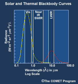
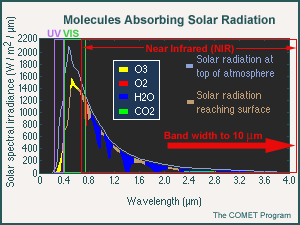
Blackbody curves of Solar Radiation at the Top of the Atmosphere and Solar Radiation reaching the Surface
|
credits:
UW-CIMSS/NOAA
copyright terms:
COMET Standard Terms of Use
description:
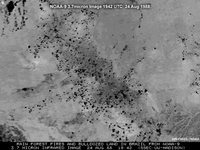
NOAA POES 3.7 micron (Near IR) image showing fires and land surface changes in Brazi
|
|
|

credits:
US Navy/NRL/NASA
copyright terms:
COMET Standard Terms of Use
description:
Aqua IR and CloudSat reflectivity of Tropical Storm Gordon
|
credits:
US Navy / NRL / NASA
copyright terms:
COMET Standard Terms of Use
description:
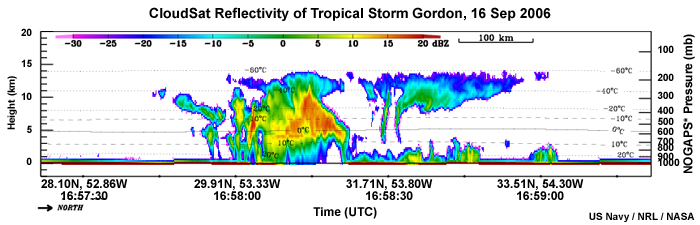
Cloudsat Profile through Tropical Storm Gordon, 16 Sep 2006
|
credits:
US Navy/NRL/NASA
copyright terms:
COMET Standard Terms of Use
description:
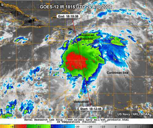
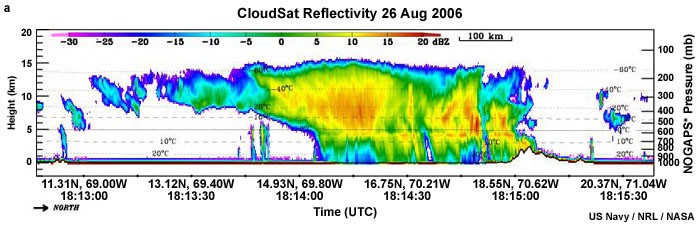
CloudSat Orbit Segment over GOES enhanced IR, 26 Aug 2006
|
credits:
US Navy/NRL/NASA
copyright terms:
COMET Standard Terms of Use
description:
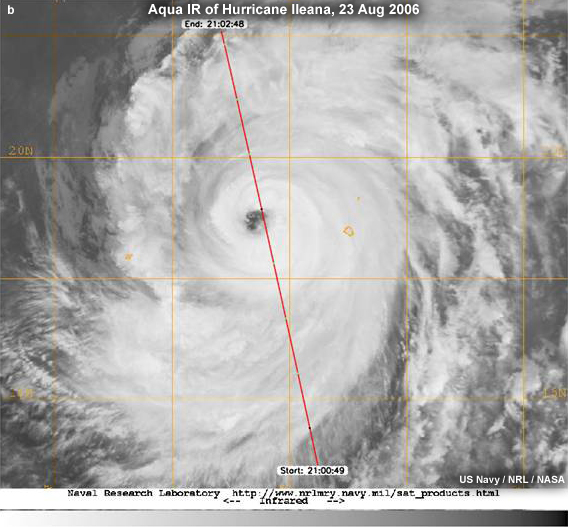
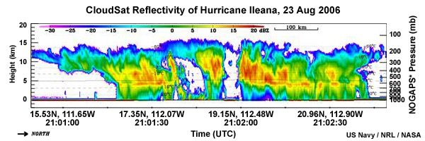
Aqua IR and CloudSat reflectivity of Hurricane Ileana
|
credits:
NASA/©EUMETSAT 2007
copyright terms:
COMET Standard Terms of Use
description:
CloudSat profile through a West African squall line
|
credits:
US Navy/NRL/NASA
copyright terms:
COMET Standard Terms of Use
description:
CloudSat reflectivity profile through developing tropical storm, Ernesto
|
|
|
|
|
|
|
|
|
|
|
credits:
H. Hashiguchi, Research Institute for Sustainable Humanosphere (RISH)
copyright terms:
COMET Standard Terms of Use
description:
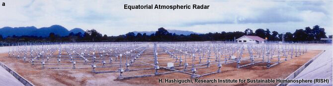
Photograph of Equatorial Atmospheric Radar
|
credits:
H. Hashiguchi, Research Institute for Sustainable Humanosphere (RISH)
copyright terms:
COMET Standard Terms of Use
description:
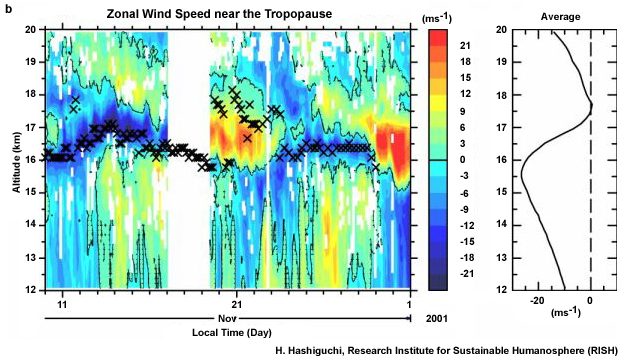
Zonal Wind speed near the Tropopause measured by the Equatorial Atmospheric Radar
|
credits:
NCAR/EOL
copyright terms:
COMET Standard Terms of Use
description:
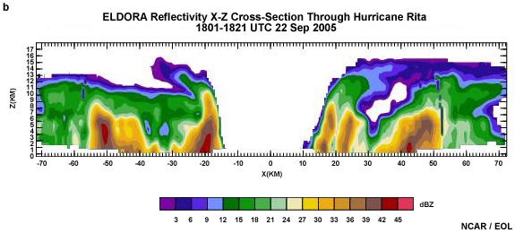
ELDORA Reflectivity X-Z cross-section through Hurricane Rita
1801-1821 UTC 22 Sep 2005
|
credits:
NCAR/EOL
copyright terms:
COMET Standard Terms of Use
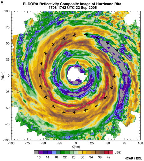
description:
ELDORA reflectivity composite image of Hurricane Rita
1706-1742 UTC 22 Sep 2005
|
|
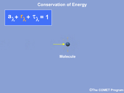
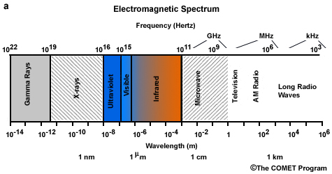
credits:
©The COMET Program
copyright terms:
COMET Standard Terms of Use
description:
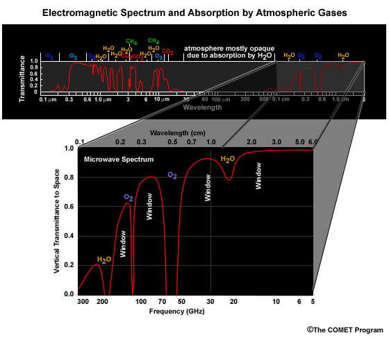
Electromagnetic Spectrum and Absorption by Atmospheric Gases
|
credits:
©The COMET Program
copyright terms:
COMET Standard Terms of Use
description:
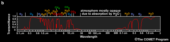
Electromagnetic Spectrum and Transmission of radiation through the atmosphere. Spectral bands where radiation is absorbed by different gases absorb radiation are marked.
|
|
|
credits:
NASA
copyright terms:
COMET Standard Terms of Use
description:
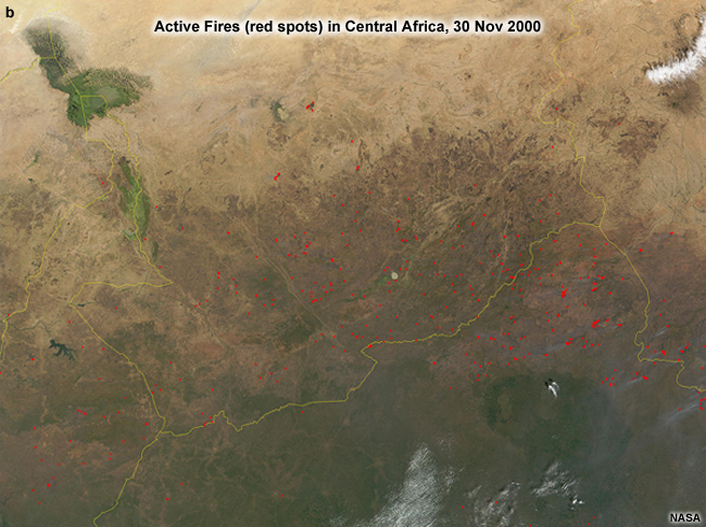
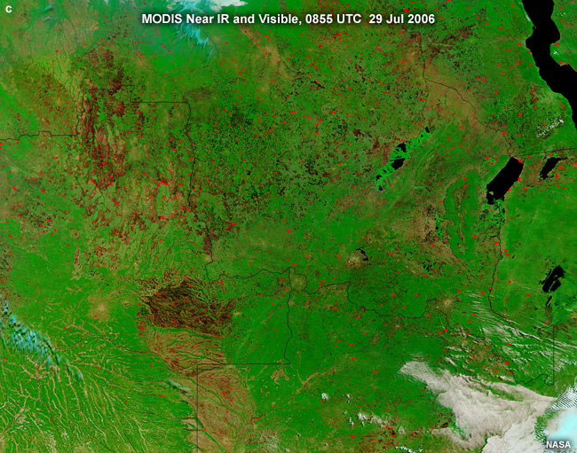
Burn scars and fire locations in Central Africa detected using MODIS shortwave near IR, and visible light.
|
|
|
|
|
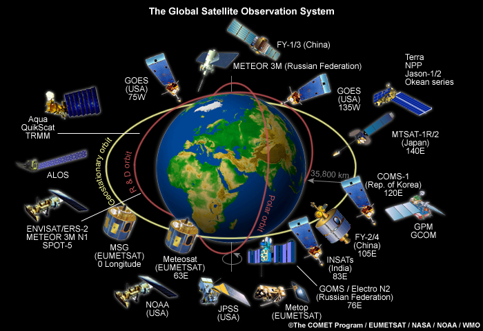
credits:
The COMET Program / EUMETSAT / NASA / NOAA / WMO
copyright terms:
COMET Standard Terms of Use
description:
The global satellite observation system
|
credits:
© The COMET Program / EUMETSAT / NASA / NOAA / WMO
copyright terms:
COMET Standard Terms of Use
description:
Global Satellite Observation System
|
|
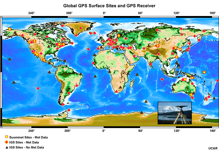
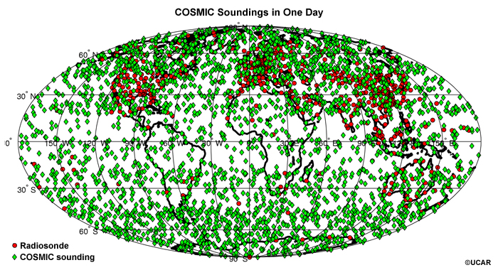
credits:
UCAR
copyright terms:
COMET Standard Terms of Use
description:
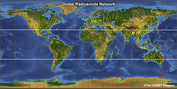
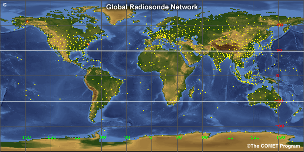
Global GPS sites with precipitable water vapor estimates and photograph of GPS receiver
|
|
|
|
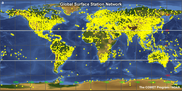
credits:
©The COMET Program
copyright terms:
COMET Standard Terms of Use
description:
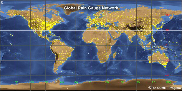
Map of Surface Synoptic and Metar Stations, 20 Mar 2007
|
|
|
credits:
Smith et al 2006
copyright terms:
COMET Standard Terms of Use
description:
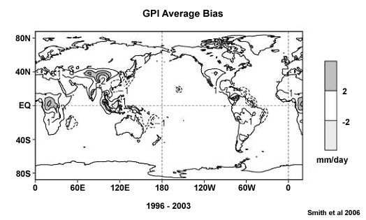
Time-average precipitation directly analyzed bias (1996-2003) for the GPI satellite estimates
|
credits:
NOAA, NASA, USAF (no change to current graphic)
copyright terms:
COMET Standard Terms of Use
description:
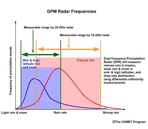
GPM Radar Frequencies
|
credits:
NOAA, NASA, USAF (no change to current graphic)
copyright terms:
COMET Standard Terms of Use
description:
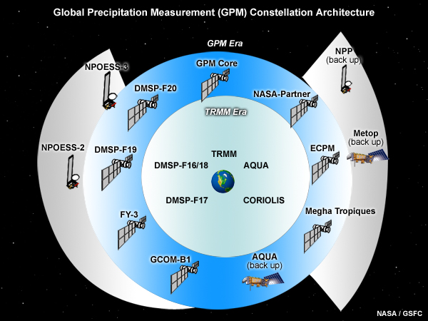
GPM Core Satellite and Constellation
|
credits:
National Meteorological Service of Jamaica
copyright terms:
COMET Standard Terms of Use
description:
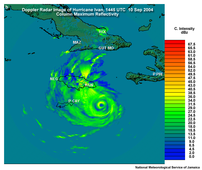
Doppler Radar Image of Hurricane Ivan, 1445 UTC 10 Sep 2004
Column Maximum Reflectivity
|
|
|
credits:
NASA
copyright terms:
COMET Standard Terms of Use
description:
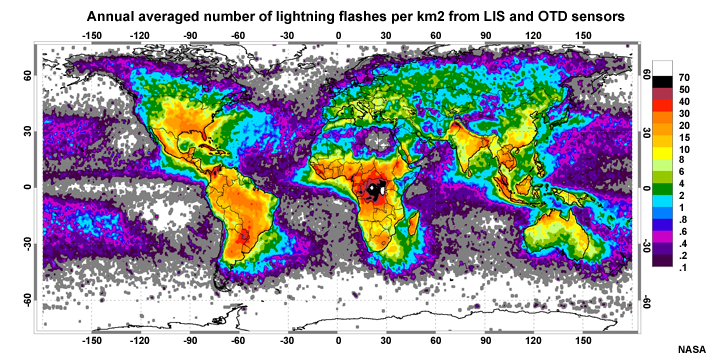
Annual averaged number of lightning flashes per km2 from merged LIS and OTD gridded data
|
credits:
NASA
copyright terms:
COMET Standard Terms of Use
description:
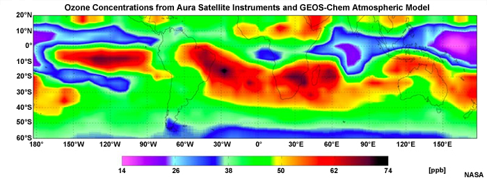
Ozone concentrations (parts per billion) calculated from Aura satellite data and the GEOS-Chem atmospheric model
|

credits:
©The COMET Program
copyright terms:
COMET Standard Terms of Use
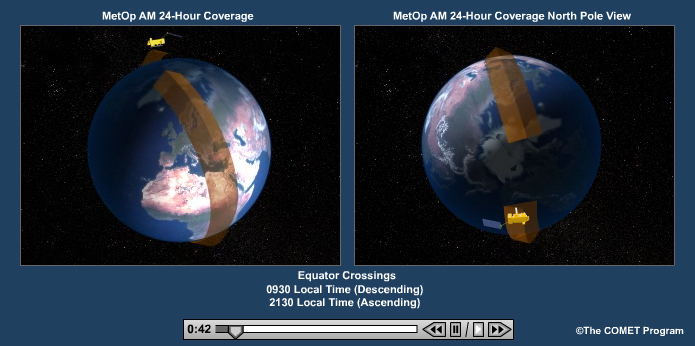
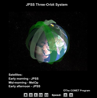
description:
24-Hour Coverage of the EUMETSAT polar-orbiting satellite, MetOp
|
credits:
NASA
copyright terms:
COMET Standard Terms of Use
description:
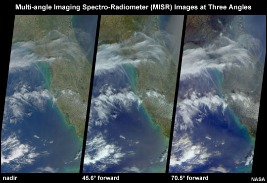
Multi-angle Imaging Spectro-Radiometer images of clouds over Florida at three angles
|
credits:
NOAA, NASA, USAF (no change to current graphic)
copyright terms:
COMET Standard Terms of Use
description:
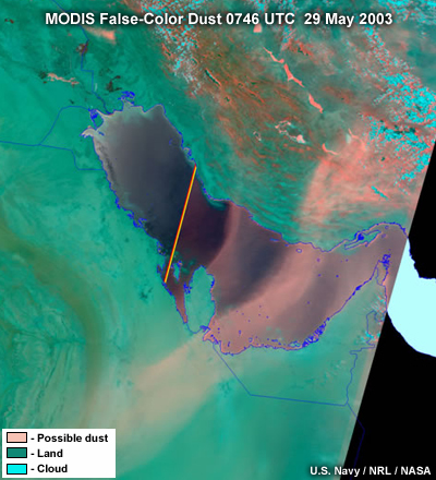
MODIS false color dust image of dust storm across the Persian Gulf, 29 May 2003
|
|
|
credits:
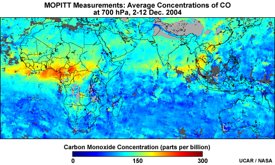
UCAR/NASA
copyright terms:
COMET Standard Terms of Use
description:
MOPITT average measured concentrations of CO at 700 hPa, 2-12 Dec. 2004
|
|
|
credits:
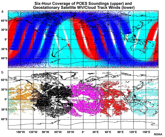
NOAA
copyright terms:
COMET Standard Terms of Use
description:
Map showing six-hour coverage of POES soundings and GOES WV/Cloud Track Winds
|
|
|
|
|
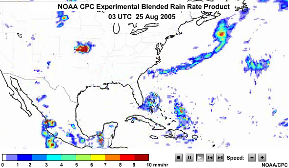
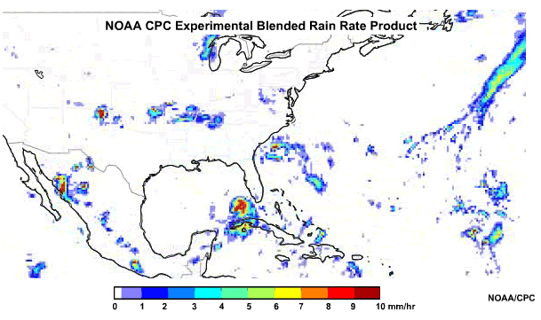
credits:
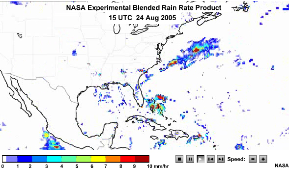
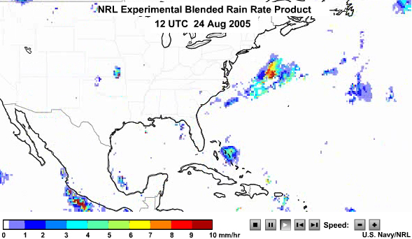
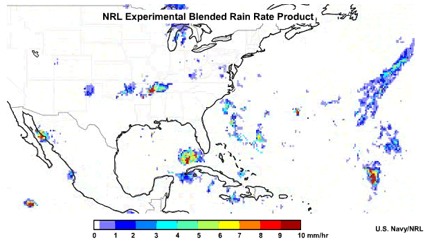
US Navy/ NRL (no change to current graphic)
copyright terms:
COMET Standard Terms of Use
description:
NRL Experimental Bleanded Rain rate Product
|
credits:
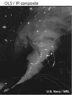
US Navy/NRL
copyright terms:
COMET Standard Terms of Use
description:
OLS and IR image of cloud and lightning flashes over Florida
|
credits:
UCAR
copyright terms:
COMET Standard Terms of Use
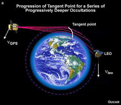
description:
Progression of tangent point for a series of progressively deeper occultations
|
credits:
NASA
copyright terms:
COMET Standard Terms of Use
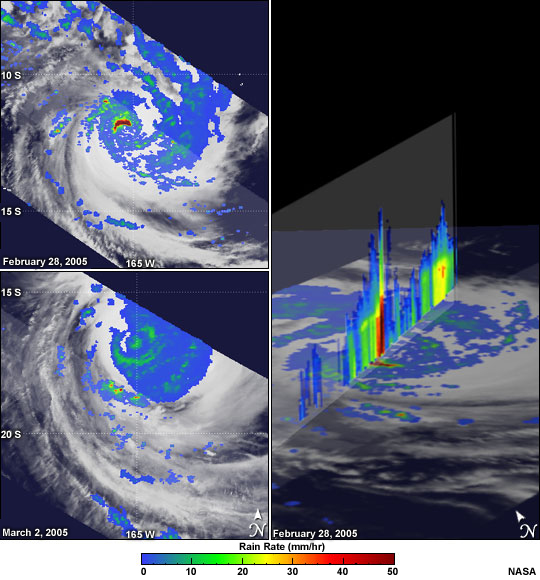
description:
TRMM PR images of Tropical Cyclone Percy including reflectivity cross-section showing towering (chimney) cumulonimbus cloud in the eyewall
|
|
credits:
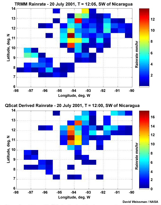
David Weissman /NASA
copyright terms:
COMET Standard Terms of Use
description:
Rainrate estimates from TMI (upper) and SeaWinds scatterometer (lower) for region southwest of Nicaragua, Central America
|
|
|
credits:
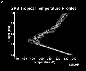
UCAR
copyright terms:
COMET Standard Terms of Use
description:
Example of tropical temperature profiles derived from GPS radio occultation
|
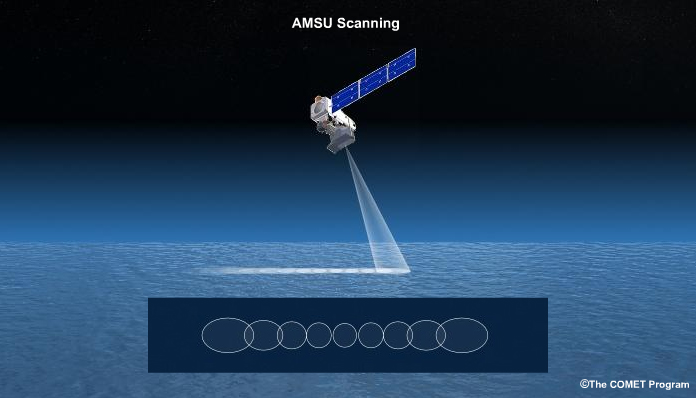
credits:
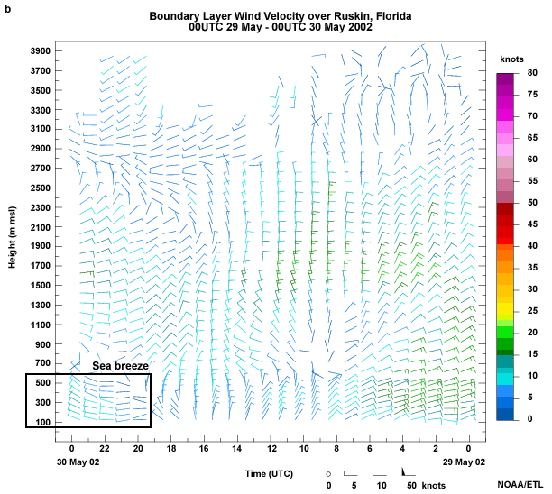
NOAA/ETL
copyright terms:
COMET Standard Terms of Use
description:
Boundary Layer Wind Velocity over Ruskin, Florida
00UTC 29 May - 00UTC 30 May 2002
|
credits:
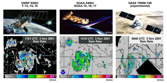
NOAA
copyright terms:
COMET Standard Terms of Use
description:
Comparison of rainfall distribution measured by the DMSP SSM/I, NOAA AMSU, and NASA TMI
|
|
credits:
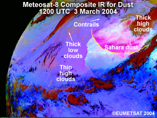
©EUMETSAT 2004
copyright terms:
COMET Standard Terms of Use
description:
Meteosat-8 Composite IR image of Saharan dust outbreak, 3-6 March 2004
|
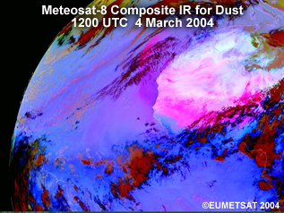
credits:
©EUMETSAT 2004
copyright terms:
COMET Standard Terms of Use
description:
Meteosat-8 Composite IR image of Saharan dust outbreak, 1200 UTC 4 March 2004
|
credits:
©EUMETSAT 2004
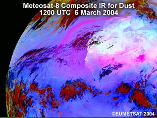
copyright terms:
COMET Standard Terms of Use
description:
Meteosat-8 Composite IR image of Saharan dust outbreak, 1200 UTC 6 March 2004
|
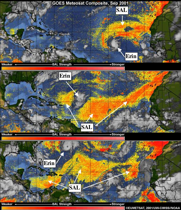
credits:
©EUMETSAT, 2001/UW-CIMSS/NOAA
copyright terms:
COMET Standard Terms of Use
description:
GOES and Meteosat Composite Images of Hurricane Erin and the Saharan Air Layer, Sep 2001
|
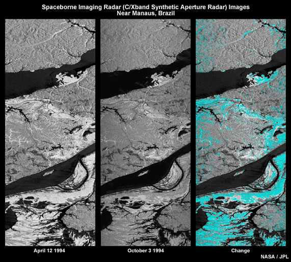
credits:
NASA/JPL
copyright terms:
COMET Standard Terms of Use
description:
Spaceborne Imaging Radar (C/Xband Synthetic Aperture Radar) Images taken in the vicinity of Manuas, Brazil
|
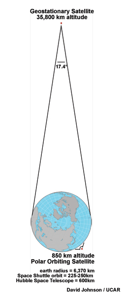
credits:
David Johnson/UCAR
copyright terms:
COMET Standard Terms of Use
description:
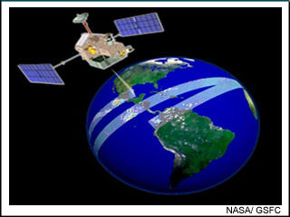
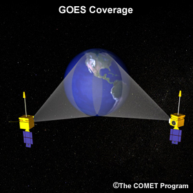
Relative orbital geometry of Geostationary and Polar Orbiting Satellites
|
credits:
©The COMET Program
copyright terms:
COMET Standard Terms of Use
description:
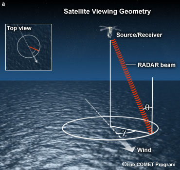
Conceptual model of Satellite Scatterometry Viewing Geometry
|
|

credits:
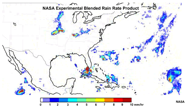
NOAA/NESDIS
copyright terms:
COMET Standard Terms of Use
description:
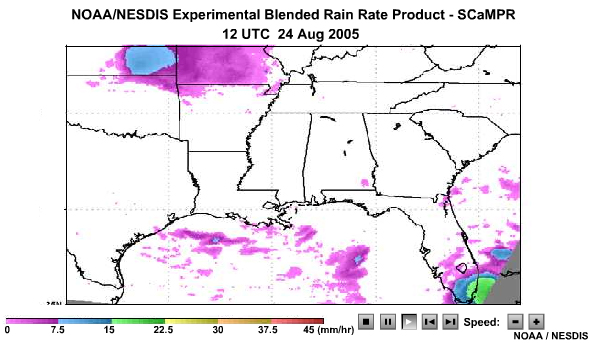
NOAA NESDIS Experimental Blended Rain rate product- SCamPR 0300UTC 25 Aug 2005
|
|
|
credits:
NOAA, DMSP
copyright terms:
COMET Standard Terms of Use
description:
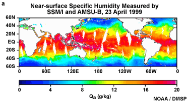
Near-surface specific humidity measured by SSM/I and AMSU-B, 23 April 1999
|

credits:
US Navy /NRL
copyright terms:
COMET Standard Terms of Use
description:
Split window technique to differentiate dust from thin cirrus
|
credits:
Smith et al. 2006
copyright terms:
COMET Standard Terms of Use
description:
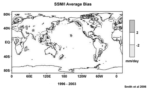
Time-average precipitation directly analyzed bias (1996-2003) for the SSM/I satellite estimates
|
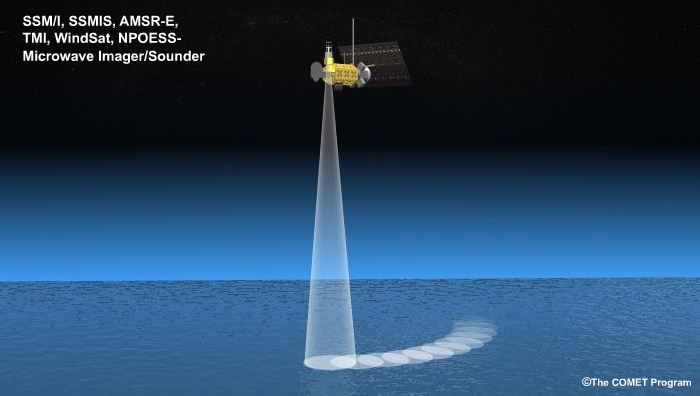
credits:
©The COMET Program
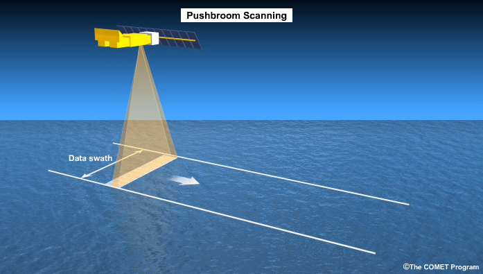
copyright terms:
COMET Standard Terms of Use
description:
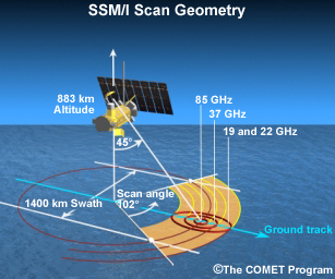
Scan geometry of the SSM/I polar orbiting satellite
|
|
credits:
The COMET Program
copyright terms:
COMET Standard Terms of Use
description:
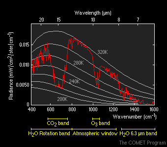
Outgoing long wave radiance curves for terrestrial temperatures and the absorption by atmospheric gases at different wavelengths or bands.
|
credits:
Courtesy of National Space Organization (NSO)
copyright terms:
COMET Standard Terms of Use
description:
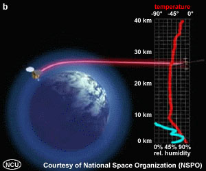
GPS satellite and sounding produced from radio occultation
|
credits:
US Navy/ NRL/ NOAA/ NASA
copyright terms:
COMET Standard Terms of Use
description:
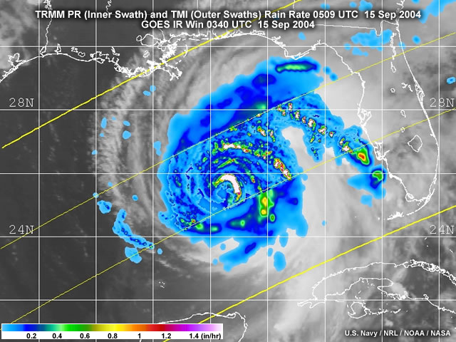
TRMM PR (inner swath) and TMI (outer swath) rain rate, 0509UTC 15 Sep 2004 and GOES IR 0340UTC 15 Sep 2004
|
credits:
Schumacher and Houze 2003
copyright terms:
COMET Standard Terms of Use
description:
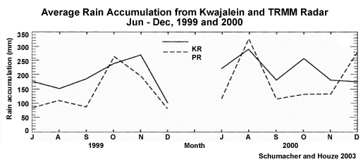
Kwajalein radar and PR monthly average rain accumulation (mm) and stratiform rainfall fraction (%) within 150km of the Kwajalein radar from Jun - Dec 1999 and 2000
|
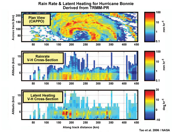
credits:
Tao et al. 2006 /NASA
copyright terms:
COMET Standard Terms of Use
description:
Plan view of near-surface rain rates for Hurricane Bonnie (22 Aug 1998); (middle) vertical cross section of rain-rate profiles along center of satellite track; (bottom) vertical cross section of latent heat profiles
|
credits:
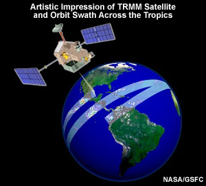
NASA
copyright terms:
COMET Standard Terms of Use
description:
Artistic impression of TRMM satellite and path across the tropics
|
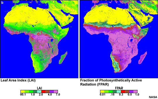
credits:
NASA
copyright terms:
COMET Standard Terms of Use
description:
The Leaf Area Index (LAI) and Fraction of Photosynthetically Active Radiation (FPAR) for Africa in December 2000
|
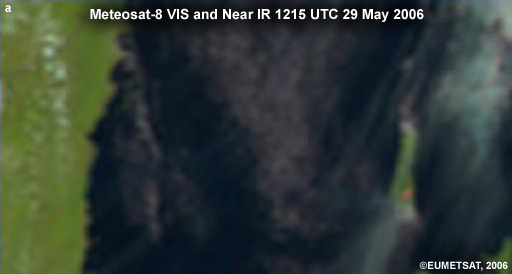
credits:
©EUMETSAT, 2006
copyright terms:
COMET Standard Terms of Use
description:
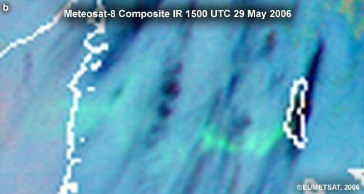
Detection of lava from the Karthala eruption, Comorros Islands (southwest Indian Ocean) on 29 May 2006.
|
credits:
©EUMETSAT, 2006
copyright terms:
COMET Standard Terms of Use
description:
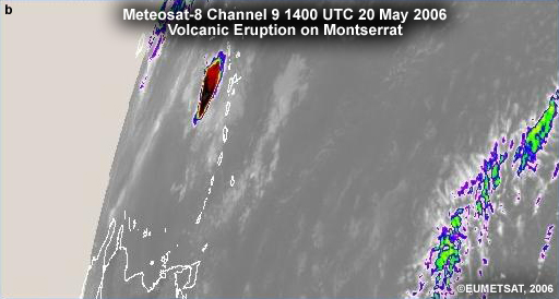
Explosive eruption of Soufriere Hills Volcano, Montserrat (Caribbean) observed by Meteosat 8
|
credits:
©EUMETSAT, 2006
copyright terms:
COMET Standard Terms of Use
description:
Detection of SO2 plume from the Karthala eruption, Comorros Islands (southwest Indian Ocean) on 29 May 2006.
|
credits:
NASA/NOAA
copyright terms:
COMET Standard Terms of Use
description:
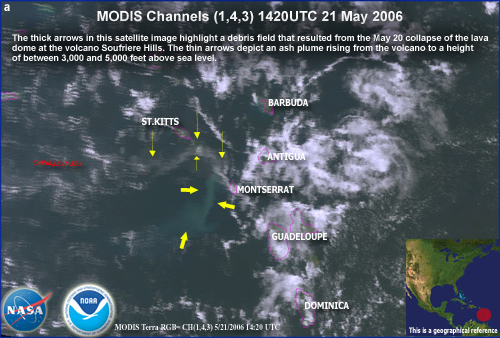
Explosive eruption of Soufriere Hills Volcano, Montserrat (Caribbean) observed by MODIS, 1420UTC 21 May 2006
|
credits:
NOAA/JMA
copyright terms:
COMET Standard Terms of Use
description:
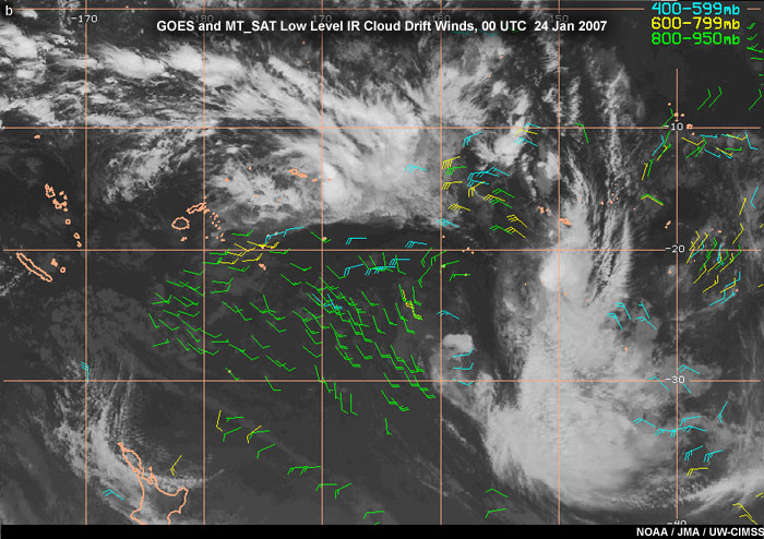
GOES and MT_SAT Low Level IR Cloud Drift Winds, 00 UTC 24 Jan 2007
|
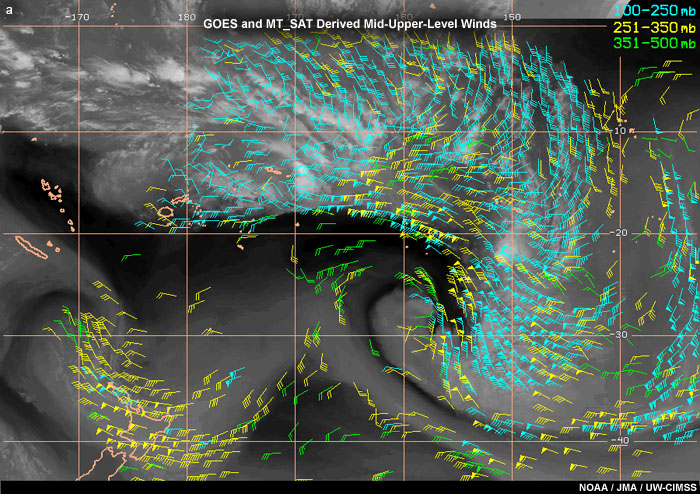
credits:
NOAA/JMA
copyright terms:
COMET Standard Terms of Use
description:
GOES and MT_SAT derived mid-upper-level winds, 00UTC 24 Jan 2007
|
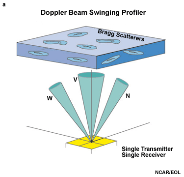
credits:
NCAR/EOL
copyright terms:
COMET Standard Terms of Use
description:
Schematic of Doppler Beam Swinging Profiler and Atmospheric Scatterers
|
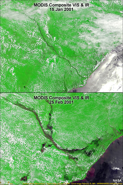
credits:
NASA
copyright terms:
COMET Standard Terms of Use
description:
Flooding of the Zambeze River (southeast Africa) detected from MODIS visible and IR composite
|